

At a Glance
- Indio earthquake rattles Riverside County with a magnitude-3.8 tremor on Tuesday.
- A stronger magnitude-4.9 quake struck the area Monday, the largest since a magnitude-5.2 event in April.
- The U.S. Geological Survey’s warning system can alert phones seconds before shaking begins.
- Aftershocks are expected to continue for days, weeks, and even months.
- Why it matters: Residents may feel the quake and need to know how to prepare and respond.
A magnitude-3.8 quake struck near Indio on Tuesday, following a day of shaking that began Monday with a 4.9-magnitude tremor. The U.S. Geological Survey (USGS) initially listed the Tuesday event at 3.6, then updated it to 3.8 after further analysis. The Monday quake was the strongest in Southern California since a 5.2-magnitude earthquake near Julian in April, and it was followed by aftershocks that continued for hours.
What Happened
The Tuesday quake occurred in Riverside County, close to the city of Indio. It was one of dozens of tremors recorded in the area over the past 24 hours. While the magnitude was lower than Monday’s, it still produced noticeable shaking for residents in the immediate vicinity.
- Magnitude-3.8: A moderate quake that can be felt by people near the epicenter.
- Monday’s 4.9: The largest quake in the region since April’s 5.2 event.
- Aftershocks: Continued shaking that can last for days or even months.
The Science Behind the Shake
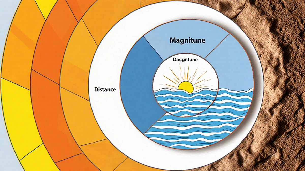
Whether or not you feel an earthquake depends on three major factors:
- Magnitude – The strength of the quake. Higher magnitude means stronger seismic waves.
- Distance – The closer you are to the epicenter, the more intense the shaking.
- Local soil conditions – Loose soil amplifies seismic waves, making the shaking feel stronger.
The quake’s energy spreads outward from the fault, becoming less intense as it moves away. If the ground beneath a building is loose, the shaking can be amplified, increasing the risk of damage.
USGS Warning System
Phones can alert users seconds before the shaking begins thanks to a complex infrastructure built by the USGS. The system monitors seismic activity in real time and sends alerts to compatible devices. The warning arrives just before the seismic waves reach the surface, giving people a brief window to take cover.
- How it works: Seismic sensors detect the initial waves and calculate the distance to the epicenter.
- Alert timing: Alerts are sent seconds before the strongest shaking arrives.
- Coverage: The system covers much of California, including Riverside County.
Aftershocks and Foreshocks
Aftershocks are smaller quakes that follow a larger event. They can continue for days, weeks, months, or even years. In some cases, an aftershock may be larger than the main event, in which case the first quake is called a foreshock.
- Example: The 2011 Japan earthquake was preceded by a 7.3 foreshock two days earlier.
- Indio aftershocks: Residents can expect continued shaking for the foreseeable future.
What Residents Should Know
- Stay alert: Keep an eye on the USGS website or download a reliable earthquake alert app.
- Emergency kit: Store essential supplies in a ready-access location.
- Safe spots: Identify drop-and-cover spots in your home or workplace.
- Aftershock readiness: Aftershocks can be unpredictable; stay prepared.
Key Takeaways
- A magnitude-3.8 quake rattled Indio on Tuesday, following Monday’s 4.9-magnitude tremor.
- The USGS’s warning system can alert phones seconds before shaking begins, giving residents a brief window to act.
- Aftershocks are expected to continue for an extended period; staying prepared is essential.
- Understanding magnitude, distance, and soil conditions helps residents gauge the potential impact.
By staying informed and prepared, residents of Riverside County can reduce the risks posed by seismic activity and respond more effectively when the next tremor occurs.